Boulevard da Paz Urban and Housing Plan


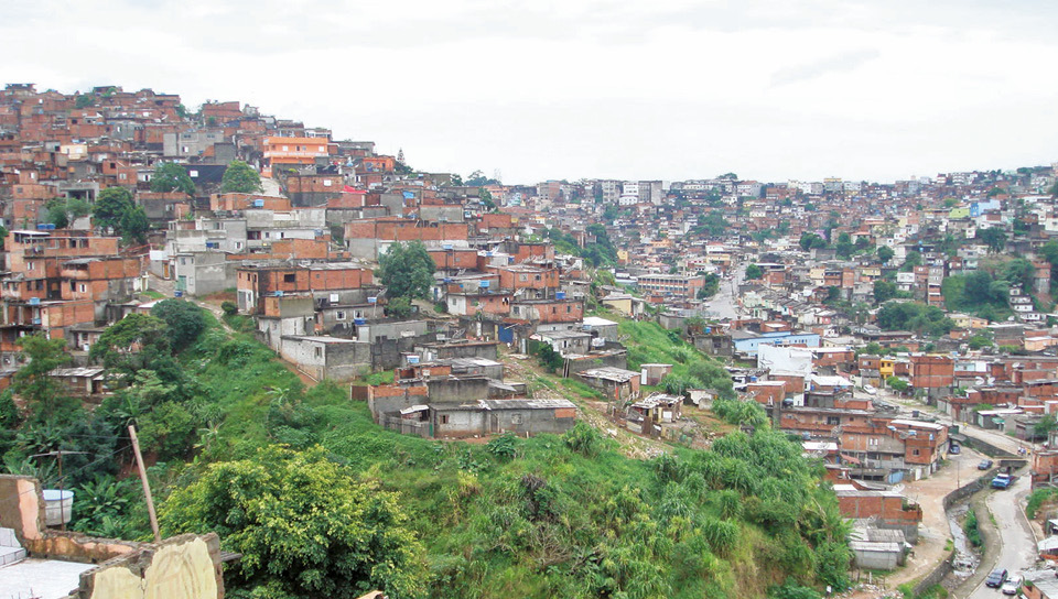
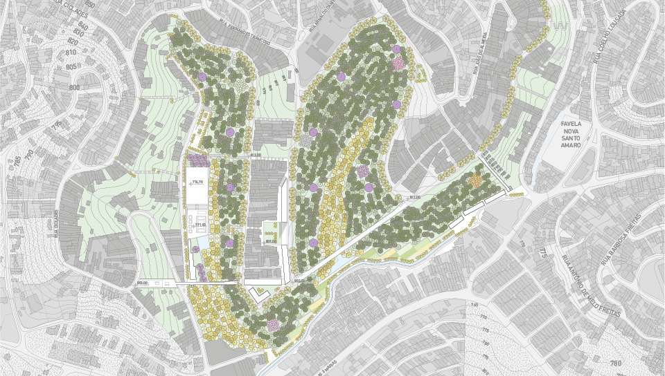
The Boulevard da Paz slum is located on a private piece of land that is part of an environmentally protected water reservoir area in the city of São Paulo. The project established an occupation strategy able to give a new meaning to the area by connecting the disperse housing clusters to its surroundings in an attempt to jointly face the environmental question of the water reservoir and the local housing needs.
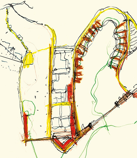
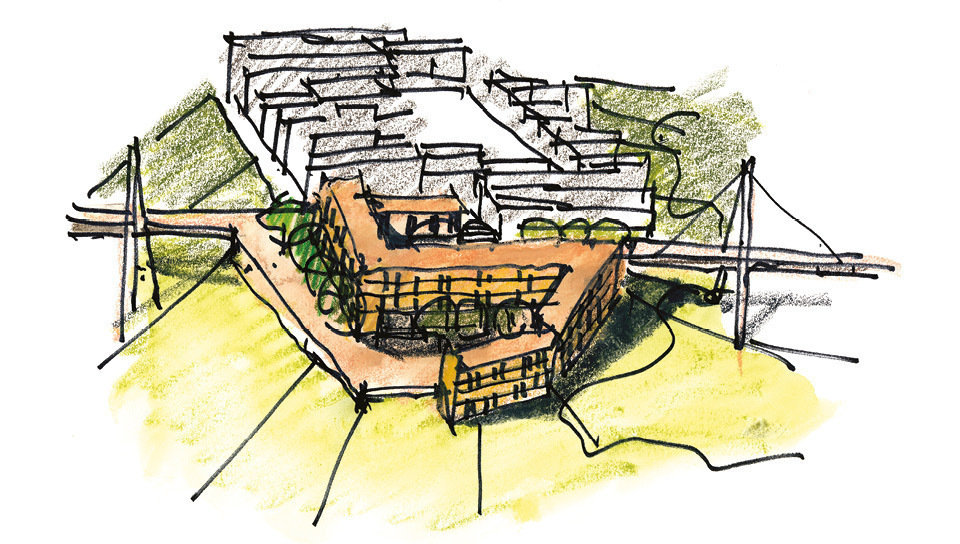
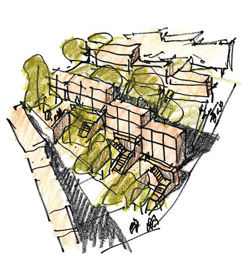
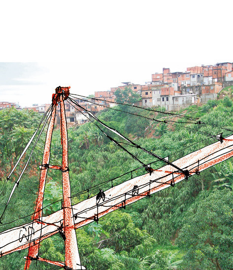
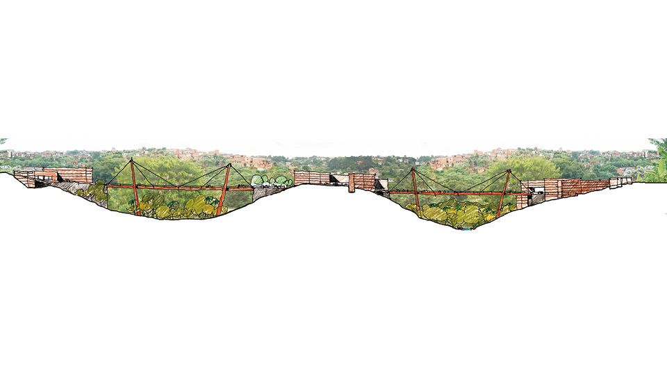
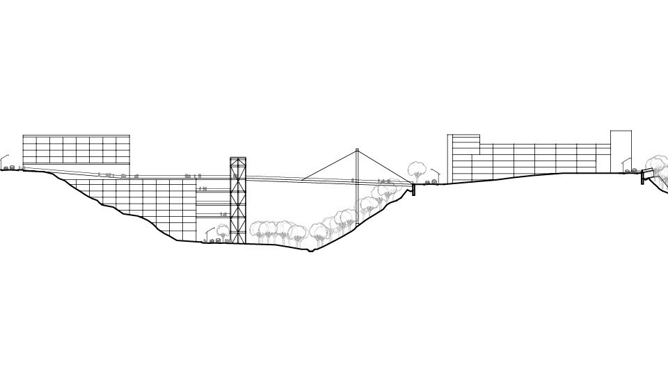
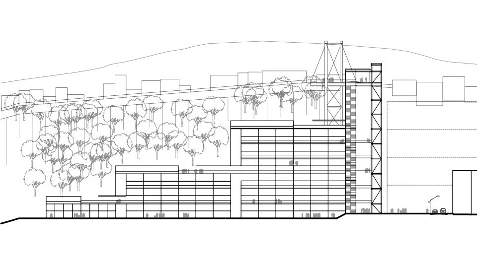
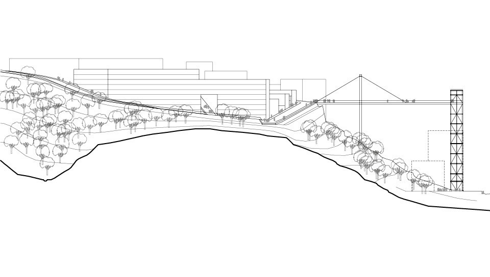
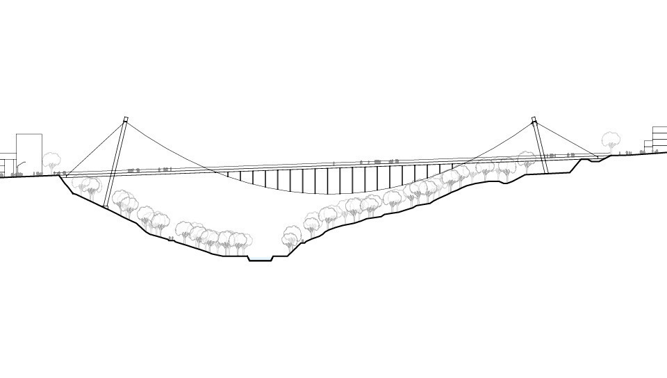
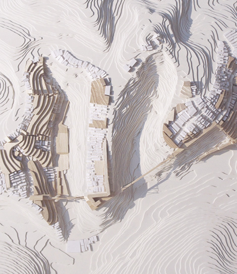
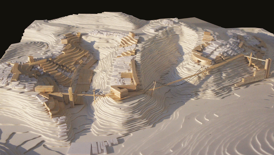
Here, the physical characteristics of the territory were strong references in the design of the urban proposal. The ridges represent areas of possible occupation. On them, housing buildings would be implemented along with public facilities and retail spaces on the vertices. The objective would be to create a centrality acting as a hub able to connect the many ground levels: to these exceptional areas, many connective walkways would be built above the valleys, making it possible to link this area to the rest of the neighborhood.
The objective of transforming these ridges into a residential area with large public facilities is to amplify the intervention area of this project so that it goes beyond the social structure of the community and the isolate territories in question.
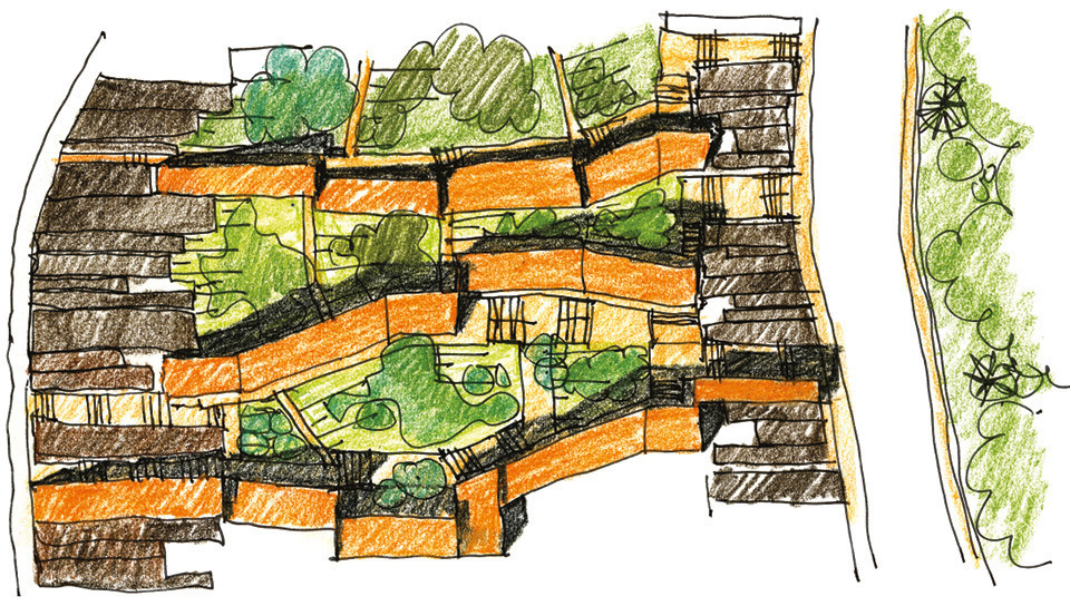
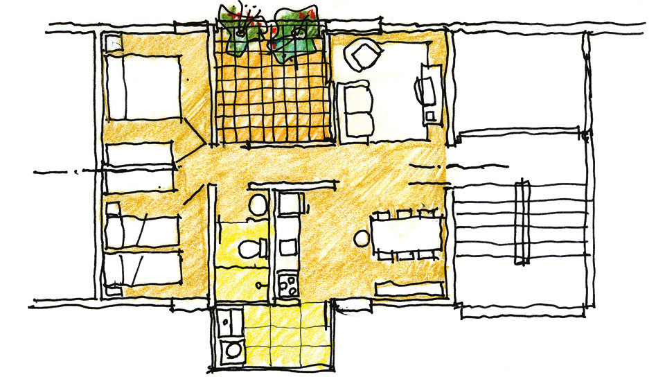
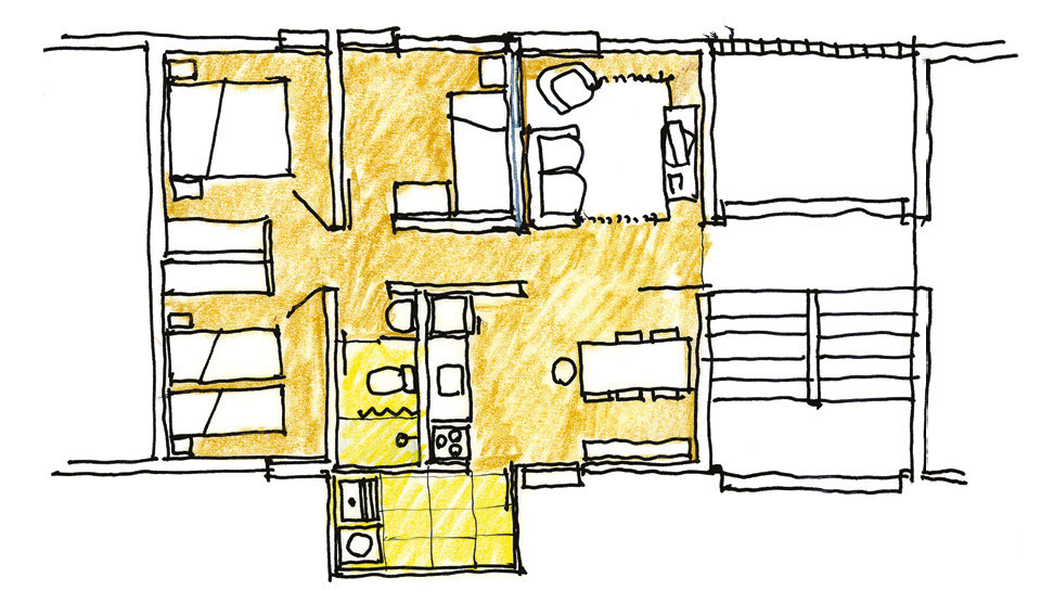
The walkways would connect the higher ground levels and become the great element of transversal integration of the complex. The hillsides that connect the ridges and the streets, would act as a base for the modular housing building, following the slopes and creating small points of interaction.
The bottom of the valleys, preserved as a park, would have their limits established by the streets on the highest ground levels, where the presence of an urban condition would offer on one side of the street, retail spaces, buildings and housing; and on the other side, the park and a circulation network able to access a future institutional facility.
The proposed transformation strategy wished to soften harsh characteristics. It is about adding urban quality to connecting elements of mobility and articulation. The project is understood as an activating agent of new situations and is conceptually understood as a part of a broader system or network of strong influence to the city.
Location:
Jardim Guarujá, São Paulo – SP
Year:
2010
Cliente:
SEHAB–HABI–SP; Consórcio Mananciais, Program Saneamento Ambiental dos Mananciais do Alto Tietê – Program Mananciais
Intervention area:
442.143 m²
Architecture and Urbanism:
VIGLIECCA&ASSOC
Héctor Vigliecca, Luciene Quel, Caroline Bertoldi, Neli Shimizu, Ronald Werner Fiedler, Bianca Riotto, Thaísa Fróes, Pedro Ichimaru, Kelly Bozzato, Aline Ollertz, Paulo Serra, Luci Maie
Management:
JNS e Hagaplan
Infrastructure:
MC Engenharia
Geotechnical Consultant:
Sérgio Murari Ludemann
Landscape Design:
Caio Boucinhas
Housing units:
1.377 units, 41,5 a 51 m²
Surrounding density:
79 hab/ha
Project density:
210 hab/ha


 Images